Revolutionizing Land Records: In a major initiative by Modi Goverment had started a unique identification for land records, with the purpose of identifying fake land records, combating land fraud, and online records of land records. The Centre is set to issue a 14-digit identification number to every plot of land in the country. The Unique Land Parcel Identification Number (ULPIN) scheme, often referred to as “the Aadhaar for land,”.
Revolutionizing Land Records:
Unique Land Identification Number (ULPIN): Key Features
The Unique Land Identification Number (ULPIN) scheme offers several key features aimed at revolutionizing land records in India. ULPIN assigns a 14-digit identification number to each surveyed plot of land across the country, providing a unique identity to every land parcel. This system serves as a powerful tool in preventing land fraud, particularly in rural areas where land records are often outdated and disputed. The identification number is generated based on the precise geospatial coordinates of the land parcel, ensuring accuracy and reliability. ULPIN is an integral part of the Digital India Land Records Modernisation Programme (DILRMP), which aims to digitize and modernize land records. It contributes to the development of an Integrated Land Information Management System (ILIMS) that includes comprehensive data on ownership, land use, taxation, boundaries, and more. By keeping land records up-to-date, ULPIN facilitates better decision-making and planning. It also streamlines citizen services, enables data sharing among departments and stakeholders, and promotes collaboration. In the future, ULPIN will be linked with banks, enhancing service delivery and financial transactions. Additionally, ULPIN supports the development of land banks, aiding efficient land management and planning for various purposes. These features together make ULPIN a significant step towards efficient land administration and transparency in India.
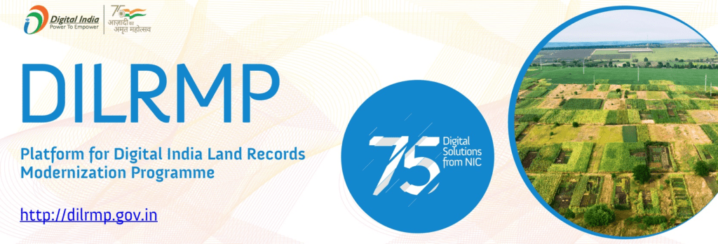
Digital India Land Records Modernisation Programme (DILRMP): A short note
The Digital India Land Records Modernisation Programme (DILRMP) is a government initiative aimed at modernizing land records in India. Launched in 2008, the program seeks to digitize land records and establish an Integrated Land Information Management System (ILIMS) across the country. It aims to streamline land administration, enhance transparency, and provide efficient land-related services to citizens. Through the DILRMP, efforts are made to update and maintain accurate land records, incorporate geospatial technology for mapping land parcels, and ensure the uniqueness of land transactions. The program also focuses on data sharing among various departments and stakeholders, facilitating better decision-making and planning. By linking land record databases with banks, the DILRMP aims to improve access to financial services and enable seamless transactions. Overall, the DILRMP plays a crucial role in transforming land records management and promoting efficient land governance in India.
Integrated Land Information Management System (ILIMS) :A short note
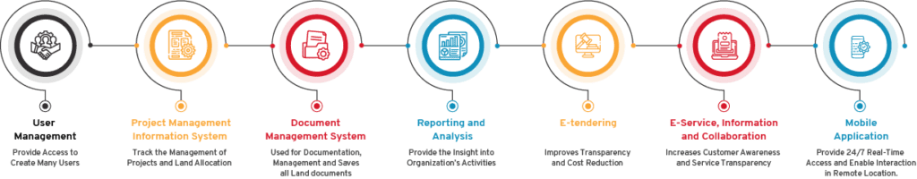
The Integrated Land Information Management System (ILIMS) is a comprehensive system developed under the Digital India Land Records Modernisation Programme (DILRMP) in India. ILIMS serves as a centralized platform for managing land-related information and records across the country. It aims to bring together various data elements such as parcel ownership details, land use information, taxation records, location boundaries
Conclusion
In conclusion, the implementation of the Unique Land Identification Number (ULPIN) scheme and the Digital India Land Records Modernisation Programme (DILRMP) mark significant advancements in land administration and records management in India. ULPIN provides a unique identity to every surveyed plot of land, helping to prevent fraud and ensure the authenticity of land transactions. The DILRMP, with its Integrated Land Information Management System (ILIMS), promotes transparency, efficiency, and accessibility in land-related information.
Who launched unique land parcel identification number?
The Unique Land Parcel Identification Number (ULPIN) scheme was launched by the Government of India.
Which ministry is under ULPIN?
The Unique Land Parcel Identification Number (ULPIN) scheme falls under the purview of the Ministry of Rural Development, specifically the Department of Land Resources.
What is unique land parcel identification number used for?
It is a 14-digit identification number accorded to a land parcel.